ProjectHome
osmdroid is a library to interact with OpenStreetMap data inside an Android application. It offers an almost full/free replacement to Android map objects: MapView, MapController, Overlays, etc.
This "OSMBonusPack" library complements osmdroid with (very) useful classes:
- Markers with nice and flexible "cartoon-bubbles",
- Routes and Directions,
- Points of Interests (directory services),
- Marker Clustering,
- Polyline, Polygon and GroundOverlay, similar to their Google Maps equivalents,
- Support for KML and GeoJSON content,
- Geocoding and Reverse Geocoding,
- Integrated Cache Management tools for off-line maps
- and more...
Have a look to the Features.
The OSMNavigator application demonstrates the use of these classes. This is a generic-purpose Map/Navigation tool, including a KML viewer and editor.
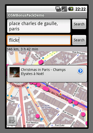
Geocoding, route display, bubble on the destination with the address and an image

Turn-by-turn instructions shown in bubbles (with instructions in the default language of the phone):

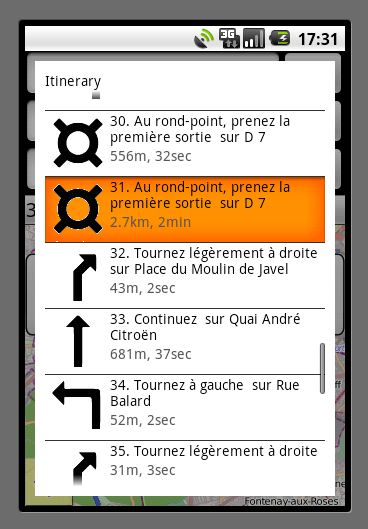
The same turn-by-turn instructions shown in list view:
Searching for fuel stations along the route:

Searching fo cinemas inside an area, with clustered markers:

Showing Wikipedia POIs related to the current map view. In the bubble, the "more info" button will open the full Wikipedia page:

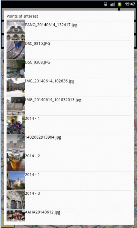
Showing geolocalized Flickr photos related to the current map view:
Showing geolocalized Picasa photos related to the current map view: 1) on the map, and 2) as a list view

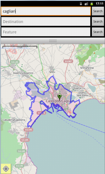
When searching a place by name, shows its enclosing polygon
MapBox Satellite maps in OSMNavigator:

Support for KML content. Example: on the left, a Google Maps "My Places", rendered with OSMBonusPack on the right:


Start with the installation guide, then follow the Tutorials.
In the Downloads, you will find the library (jar file), the javadoc, and the OSMNavigator application.